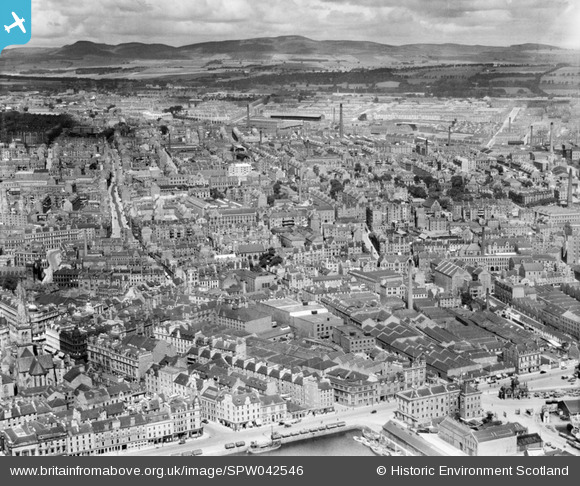
SPW042546 SCOTLAND (1933). Dundee, general view, showing Custom House and Hilltown. An oblique aerial photograph taken facing north.
© Copyright OpenStreetMap contributors and licensed by the OpenStreetMap Foundation. 2026. Cartography is licensed as CC BY-SA.
Details
| Title | [SPW042546] Dundee, general view, showing Custom House and Hilltown. An oblique aerial photograph taken facing north. |
| Reference | SPW042546 |
| Date | 1933 |
| Link | NRHE Collection item 1257639 |
| Place name | |
| Parish | DUNDEE (DUNDEE, CITY OF) |
| District | CITY OF DUNDEE |
| Country | SCOTLAND |
| Easting / Northing | 340510, 730810 |
| Longitude / Latitude | -2.9656127672068, 56.465769904324 |
| National Grid Reference | NO405308 |


![[SPW042546] Dundee, general view, showing Custom House and Hilltown. An oblique aerial photograph taken facing north.](http://britainfromabove.org.uk/sites/all/libraries/aerofilms-images/public/100x100/SPW/042/SPW042546.jpg)
![[SAW009807] Dundee, general view, showing Victoria Street and Dudhope Park. An oblique aerial photograph taken facing west.](http://britainfromabove.org.uk/sites/all/libraries/aerofilms-images/public/100x100/SAW/009/SAW009807.jpg)
