
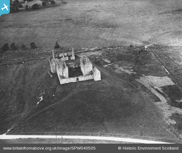
SPW040505 SCOTLAND (1932). Ruthven Barracks, Kingussie. An oblique aerial photograph taken facing north-west. This image has been produced from a print.
© Copyright OpenStreetMap contributors and licensed by the OpenStreetMap Foundation. 2025. Cartography is licensed as CC BY-SA.
Nearby Images (2)
SPW040504

SPW040505

Details
| Title | [SPW040505] Ruthven Barracks, Kingussie. An oblique aerial photograph taken facing north-west. This image has been produced from a print. |
| Reference | SPW040505 |
| Date | 1932 |
| Link | Canmore Collection item 1315516 |
| Place name | |
| Parish | KINGUSSIE AND INSH |
| District | BADENOCH AND STRATHSPEY |
| Country | SCOTLAND |
| Easting / Northing | 276473, 799756 |
| Longitude / Latitude | -4.0377693902463, 57.072410081665 |
| National Grid Reference | NN765998 |
Pins

JMB |
Wednesday 31st of July 2013 11:30:29 PM |