
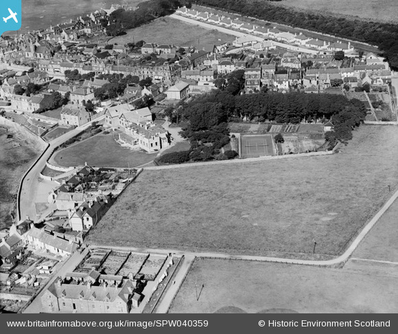
SPW040359 SCOTLAND (1932). Elie, general view, showing The Toft and Woodside Road. An oblique aerial photograph taken facing north.
© Copyright OpenStreetMap contributors and licensed by the OpenStreetMap Foundation. 2026. Cartography is licensed as CC BY-SA.
Nearby Images (13)
SPW040353

SPW040354

SPW040355

SPW040356

SPW040357

SPW040358

SPW040359

SPW040360

SPW040361

SPW040362

SPW040363

SPW040398

SPW040400

Details
| Title | [SPW040359] Elie, general view, showing The Toft and Woodside Road. An oblique aerial photograph taken facing north. |
| Reference | SPW040359 |
| Date | 1932 |
| Link | NRHE Collection item 1257421 |
| Place name | |
| Parish | ELIE |
| District | NORTH EAST FIFE |
| Country | SCOTLAND |
| Easting / Northing | 349376, 699994 |
| Longitude / Latitude | -2.8157954860645, 56.189943824641 |
| National Grid Reference | NT4941000 |
Pins
Be the first to add a comment to this image!