
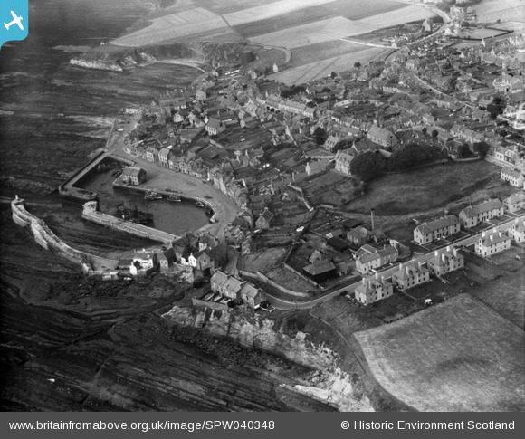
SPW040348 SCOTLAND (1932). Pittenweem, general view, showing Pittenweem Harbour and Priory. An oblique aerial photograph taken facing west.
© Copyright OpenStreetMap contributors and licensed by the OpenStreetMap Foundation. 2026. Cartography is licensed as CC BY-SA.
Nearby Images (5)
SPW040348

SPW040350

SPW040347

SAR023036

SAR023037

Details
| Title | [SPW040348] Pittenweem, general view, showing Pittenweem Harbour and Priory. An oblique aerial photograph taken facing west. |
| Reference | SPW040348 |
| Date | 1932 |
| Link | NRHE Collection item 1257405 |
| Place name | |
| Parish | PITTENWEEM |
| District | NORTH EAST FIFE |
| Country | SCOTLAND |
| Easting / Northing | 355023, 702521 |
| Longitude / Latitude | -2.7252322784804, 56.213215040019 |
| National Grid Reference | NO550025 |
Pins
Be the first to add a comment to this image!