
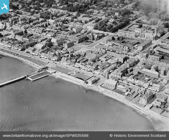
SPW035688 SCOTLAND (1931). Helensburgh, general view, showing Clyde Street and Colquhoun Square. An oblique aerial photograph taken facing north.
© Copyright OpenStreetMap contributors and licensed by the OpenStreetMap Foundation. 2026. Cartography is licensed as CC BY-SA.
Nearby Images (4)
SPW035688

SPW019584

SPW019586

SAW026580

Details
| Title | [SPW035688] Helensburgh, general view, showing Clyde Street and Colquhoun Square. An oblique aerial photograph taken facing north. |
| Reference | SPW035688 |
| Date | 1931 |
| Link | NRHE Collection item 1257209 |
| Place name | |
| Parish | RHU |
| District | DUMBARTON |
| Country | SCOTLAND |
| Easting / Northing | 229561, 682289 |
| Longitude / Latitude | -4.733685927349, 56.003244853872 |
| National Grid Reference | NS296823 |
Pins

daz |
Sunday 10th of February 2013 09:59:17 AM |