
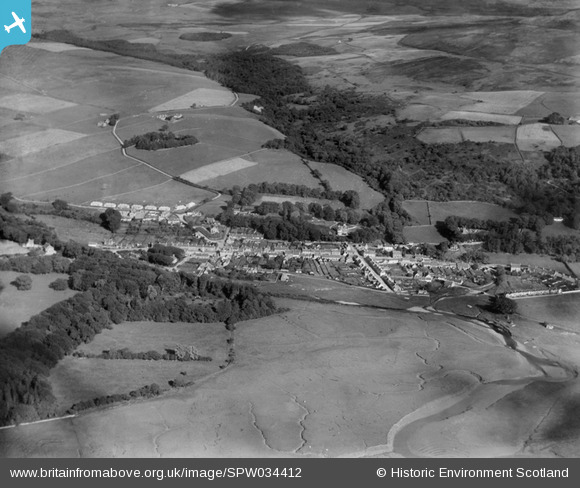
SPW034412 SCOTLAND (1930). Creetown, general view, showing St John Street and Hill of Burns. An oblique aerial photograph taken facing east.
© Copyright OpenStreetMap contributors and licensed by the OpenStreetMap Foundation. 2025. Cartography is licensed as CC BY-SA.
Nearby Images (5)
SPW034412

SPW034416

SPW034414

SPW034415

SPW034413

Details
| Title | [SPW034412] Creetown, general view, showing St John Street and Hill of Burns. An oblique aerial photograph taken facing east. |
| Reference | SPW034412 |
| Date | 1930 |
| Link | NRHE Collection item 1257142 |
| Place name | |
| Parish | KIRKMABRECK |
| District | WIGTOWN |
| Country | SCOTLAND |
| Easting / Northing | 247620, 558690 |
| Longitude / Latitude | -4.3766380061276, 54.899577084727 |
| National Grid Reference | NX476587 |
Pins
 [eBay} - Copy_0.jpg)
ChesterMan |
Thursday 23rd of October 2014 03:34:41 PM | |
|
ChesterMan |
Thursday 23rd of October 2014 03:32:13 PM | |
|
ChesterMan |
Thursday 23rd of October 2014 03:30:37 PM | |
|
ChesterMan |
Thursday 23rd of October 2014 03:29:44 PM |