
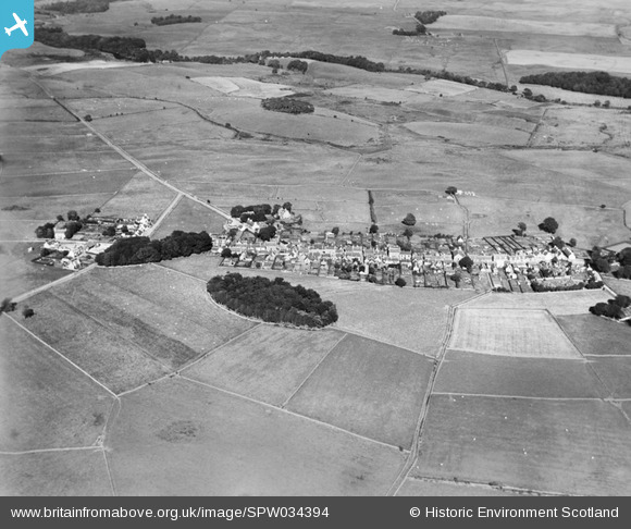
SPW034394 SCOTLAND (1930). Kirkcowan, general view, showing Main Street and Knockbreck. An oblique aerial photograph taken facing east.
© Copyright OpenStreetMap contributors and licensed by the OpenStreetMap Foundation. 2026. Cartography is licensed as CC BY-SA.
Nearby Images (4)
SPW034394

SPW034395

SPW034396

SPW034397

Details
| Title | [SPW034394] Kirkcowan, general view, showing Main Street and Knockbreck. An oblique aerial photograph taken facing east. |
| Reference | SPW034394 |
| Date | 1930 |
| Link | NRHE Collection item 1257120 |
| Place name | |
| Parish | KIRKCOWAN |
| District | WIGTOWN |
| Country | SCOTLAND |
| Easting / Northing | 232863, 560824 |
| Longitude / Latitude | -4.6077850887729, 54.91401923183 |
| National Grid Reference | NX329608 |
Pins
Be the first to add a comment to this image!