
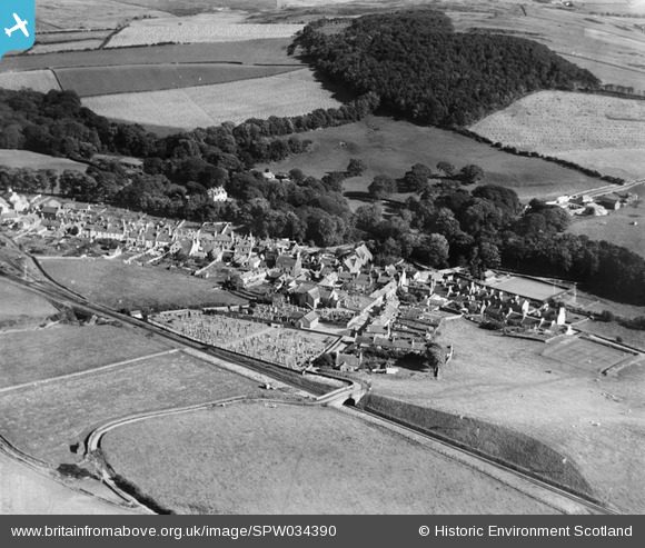
SPW034390 SCOTLAND (1930). Glenluce, general view, showing Main Street and Old Luce Parish Church, Church Street. An oblique aerial photograph taken facing south-east.
© Copyright OpenStreetMap contributors and licensed by the OpenStreetMap Foundation. 2026. Cartography is licensed as CC BY-SA.
Nearby Images (5)
SPW034390

SPW034391

SPW034388

SPW034393

SPW034392

Details
| Title | [SPW034390] Glenluce, general view, showing Main Street and Old Luce Parish Church, Church Street. An oblique aerial photograph taken facing south-east. |
| Reference | SPW034390 |
| Date | 1930 |
| Link | NRHE Collection item 1257116 |
| Place name | |
| Parish | OLD LUCE |
| District | WIGTOWN |
| Country | SCOTLAND |
| Easting / Northing | 219789, 557387 |
| Longitude / Latitude | -4.8093612396953, 54.878621477356 |
| National Grid Reference | NX198574 |
Pins

MikeL |
Friday 19th of June 2020 11:05:24 PM |