
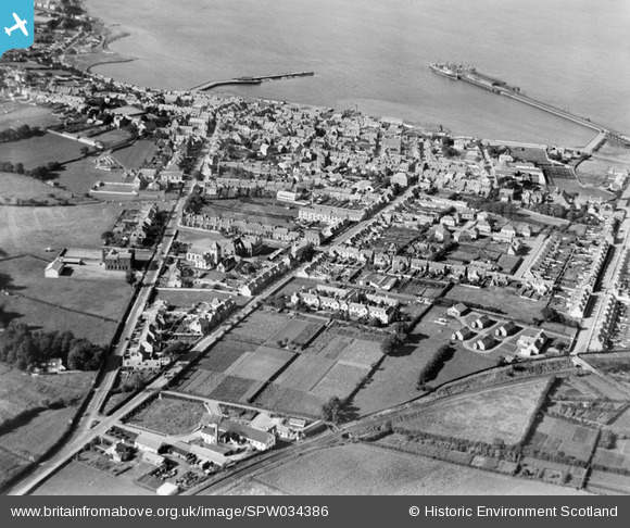
SPW034386 SCOTLAND (1930). Stranraer, general view, showing Stranraer Harbour and Dalrymple Street. An oblique aerial photograph taken facing north.
© Copyright OpenStreetMap contributors and licensed by the OpenStreetMap Foundation. 2025. Cartography is licensed as CC BY-SA.
Nearby Images (2)
SPW034386

SPW034385

Details
| Title | [SPW034386] Stranraer, general view, showing Stranraer Harbour and Dalrymple Street. An oblique aerial photograph taken facing north. |
| Reference | SPW034386 |
| Date | 1930 |
| Link | Canmore Collection item 1257112 |
| Place name | |
| Parish | STRANRAER |
| District | WIGTOWN |
| Country | SCOTLAND |
| Easting / Northing | 206260, 560413 |
| Longitude / Latitude | -5.0219878782494, 54.900722593337 |
| National Grid Reference | NX063604 |
Pins

MB |
Wednesday 3rd of February 2021 03:51:15 PM |