
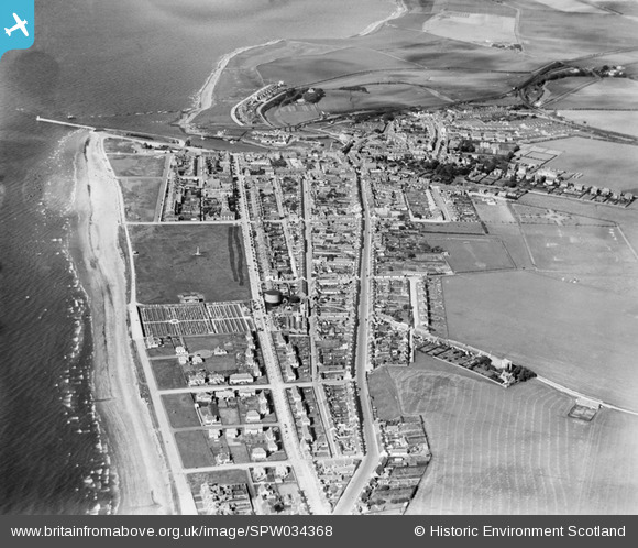
SPW034368 SCOTLAND (1930). Girvan, general view, showing Stair Park and Dalrymple Street. An oblique aerial photograph taken facing north.
© Copyright OpenStreetMap contributors and licensed by the OpenStreetMap Foundation. 2025. Cartography is licensed as CC BY-SA.
Nearby Images (6)
SPW034368

SPW034366

SPW051054

SAR019166

SPW034369

SPW034370

Details
| Title | [SPW034368] Girvan, general view, showing Stair Park and Dalrymple Street. An oblique aerial photograph taken facing north. |
| Reference | SPW034368 |
| Date | 1930 |
| Link | NRHE Collection item 1257089 |
| Place name | |
| Parish | GIRVAN |
| District | KYLE AND CARRICK |
| Country | SCOTLAND |
| Easting / Northing | 218531, 597617 |
| Longitude / Latitude | -4.8545450391841, 55.239274059572 |
| National Grid Reference | NX185976 |
Pins

Girvanbhoy |
Thursday 30th of September 2021 05:42:00 PM | |
|
MWM |
Monday 1st of June 2020 06:23:36 PM | |
|
mlceates |
Wednesday 12th of March 2014 11:32:00 PM | |
|
McWhirter |
Thursday 20th of September 2012 03:13:33 PM | |
|
McWhirter |
Thursday 20th of September 2012 03:12:48 PM | |
No, the street one to the left is Henrietta street |
mlceates |
Wednesday 12th of March 2014 11:29:09 PM |
|
McWhirter |
Thursday 20th of September 2012 03:11:45 PM | |
|
ballantrae history |
Thursday 28th of June 2012 11:15:37 PM | |
The aeroplane looks as if it might be an Avro 504, with two bell tents. |
Graham Yaxley |
Thursday 8th of January 2015 06:23:10 PM |
|
Alan McFarlane |
Thursday 14th of June 2012 08:08:50 PM |