
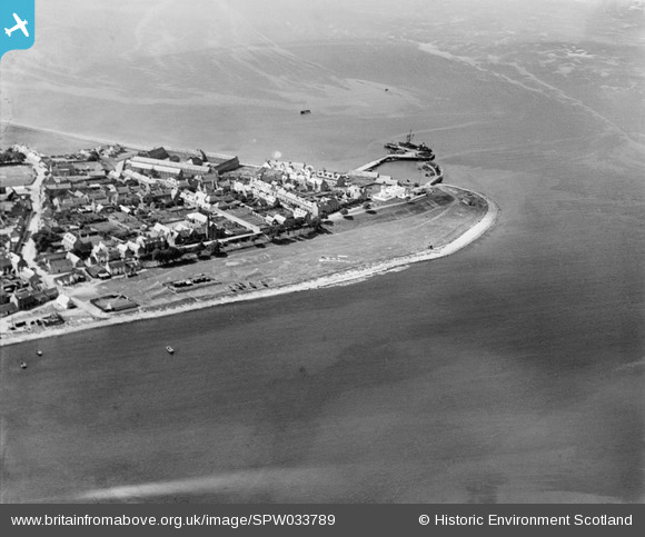
SPW033789 SCOTLAND (1930). Cromarty, a general view, showing The Links and Cromarty Harbour. An oblique aerial photograph taken facing west.
© Copyright OpenStreetMap contributors and licensed by the OpenStreetMap Foundation. 2026. Cartography is licensed as CC BY-SA.
Nearby Images (6)
SPW033789

SPW033790

SPW033791

SPW033788

SPW033787

SPW033784

Details
| Title | [SPW033789] Cromarty, a general view, showing The Links and Cromarty Harbour. An oblique aerial photograph taken facing west. |
| Reference | SPW033789 |
| Date | 1930 |
| Link | NRHE Collection item 1298001 |
| Place name | |
| Parish | CROMARTY |
| District | ROSS AND CROMARTY |
| Country | SCOTLAND |
| Easting / Northing | 278776, 867724 |
| Longitude / Latitude | -4.0333082027415, 57.683251323099 |
| National Grid Reference | NH788677 |
Pins
Be the first to add a comment to this image!