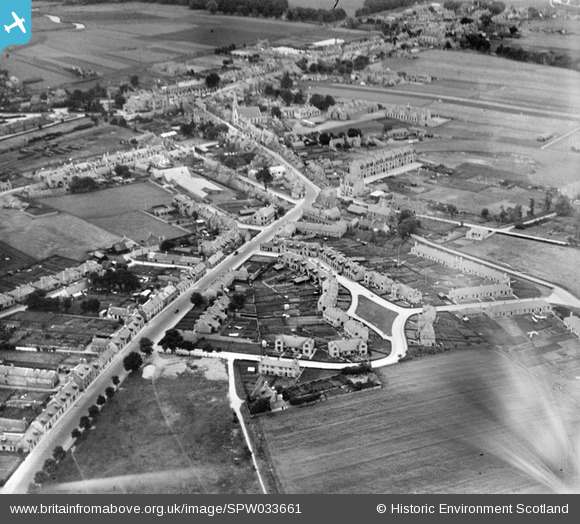
SPW033661 SCOTLAND (1930). Inverurie, general view, showing North Street and West High Street. An oblique aerial photograph taken facing east.
© Copyright OpenStreetMap contributors and licensed by the OpenStreetMap Foundation. 2025. Cartography is licensed as CC BY-SA.
Details
| Title | [SPW033661] Inverurie, general view, showing North Street and West High Street. An oblique aerial photograph taken facing east. |
| Reference | SPW033661 |
| Date | 1930 |
| Link | Canmore Collection item 1257002 |
| Place name | |
| Parish | INVERURIE |
| District | GORDON |
| Country | SCOTLAND |
| Easting / Northing | 377150, 821627 |
| Longitude / Latitude | -2.379084022782, 57.284896101074 |
| National Grid Reference | NJ772216 |
Pins
 Solkid |
Tuesday 11th of April 2017 12:45:41 AM |
User Comment Contributions
Interesting. |
 Cam |
Thursday 21st of January 2016 10:41:54 AM |


![[SPW033660] Inverurie, general view, showing North Street and West High Street. An oblique aerial photograph taken facing south-east.](http://britainfromabove.org.uk/sites/all/libraries/aerofilms-images/public/100x100/SPW/033/SPW033660.jpg)
![[SPW033661] Inverurie, general view, showing North Street and West High Street. An oblique aerial photograph taken facing east.](http://britainfromabove.org.uk/sites/all/libraries/aerofilms-images/public/100x100/SPW/033/SPW033661.jpg)
![[SPW033656] Inverurie, general view, showing West High Street and Victoria Street. An oblique aerial photograph taken facing east. This image has been produced from a print.](http://britainfromabove.org.uk/sites/all/libraries/aerofilms-images/public/100x100/SPW/033/SPW033656.jpg)