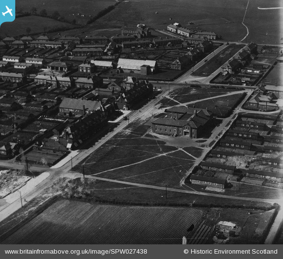
SPW027438 SCOTLAND (1929). East Wemyss, general view, showing Wemyss Parish Church and Main Street. An oblique aerial photograph taken facing north-west.
© Copyright OpenStreetMap contributors and licensed by the OpenStreetMap Foundation. 2026. Cartography is licensed as CC BY-SA.
Details
| Title | [SPW027438] East Wemyss, general view, showing Wemyss Parish Church and Main Street. An oblique aerial photograph taken facing north-west. |
| Reference | SPW027438 |
| Date | 1929 |
| Link | NRHE Collection item 1259367 |
| Place name | |
| Parish | WEMYSS |
| District | KIRKCALDY |
| Country | SCOTLAND |
| Easting / Northing | 334025, 696759 |
| Longitude / Latitude | -3.0623284487056, 56.159001639746 |
| National Grid Reference | NT340968 |
Pins
Be the first to add a comment to this image!
User Comment Contributions
Hi flyfifer You were right not to recognise the places shown as East Wemyss. I did a little investigation and I've found the same photo identified as :- Title Gretna, general view, showing The Institute and All Saints Episcopal Church. An oblique aerial photograph taken facing north. Image reference SPW027435 Date 31st December 1929 Looks like it's Gretna and not East Wemyss! |

Class31 |
Thursday 12th of February 2015 08:47:21 AM |
I'm not recognising any of these buildings, don't think this is East Wemyss???? |

flyfifer |
Thursday 12th of February 2015 12:14:00 AM |
I'm not recognising any of these buildings, don't think this is East Wemyss???? |

flyfifer |
Thursday 12th of February 2015 12:13:57 AM |


![[SPW027438] East Wemyss, general view, showing Wemyss Parish Church and Main Street. An oblique aerial photograph taken facing north-west.](http://britainfromabove.org.uk/sites/all/libraries/aerofilms-images/public/100x100/SPW/027/SPW027438.jpg)
![[SPW027434] East Wemyss, general view, showing Wemyss Parish Church, Main Street and High Road. An oblique aerial photograph taken facing north. This image has been produced from a print.](http://britainfromabove.org.uk/sites/all/libraries/aerofilms-images/public/100x100/SPW/027/SPW027434.jpg)
![[SAR031677] General View Wemyss, Fife, Scotland. An oblique aerial photograph taken facing North/East. This image was marked by AeroPictorial Ltd for photo editing.](http://britainfromabove.org.uk/sites/all/libraries/aerofilms-images/public/100x100/SAR/031/SAR031677.jpg)