
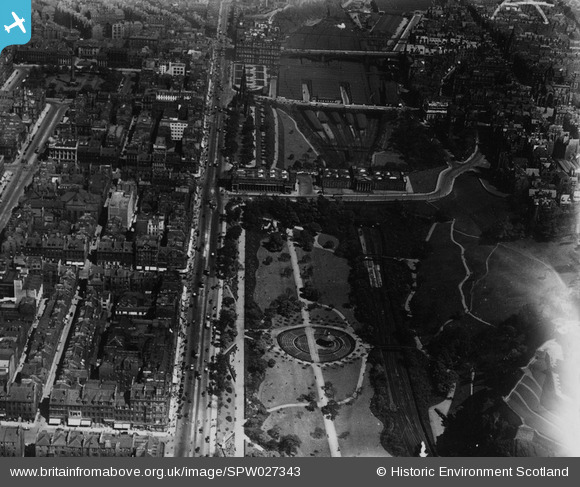
SPW027343 SCOTLAND (1929). Edinburgh, general view, showing Princes Street and Waverley Station. An oblique aerial photograph taken facing east. This image has been produced from a marked print.
© Copyright OpenStreetMap contributors and licensed by the OpenStreetMap Foundation. 2026. Cartography is licensed as CC BY-SA.
Nearby Images (30)
SPW027343

SAR008700

SAR008701

SAR021179

SAR021181

SAR021202

SAR022326

SAR029124

SAR029125

SAR029126

SAR033371

SAR033377

SPW027317

SAR010381

SAR010388

SPW027325

SAW010250

SPW040193

SPW027132

SPW056031

SPW056032

SAW009821

SAW010251

SAW010253

SAW010260

SAW010261

SPW056027

SPW056028

SPW056029

SPW056030

Details
| Title | [SPW027343] Edinburgh, general view, showing Princes Street and Waverley Station. An oblique aerial photograph taken facing east. This image has been produced from a marked print. |
| Reference | SPW027343 |
| Date | 1929 |
| Link | NRHE Collection item 1315447 |
| Place name | |
| Parish | EDINBURGH (EDINBURGH, CITY OF) |
| District | CITY OF EDINBURGH |
| Country | SCOTLAND |
| Easting / Northing | 325336, 673802 |
| Longitude / Latitude | -3.1958066358984, 55.951481437655 |
| National Grid Reference | NT253738 |
Pins
Be the first to add a comment to this image!