
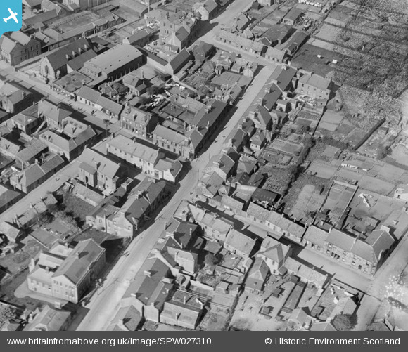
SPW027310 SCOTLAND (1929). Lochgelly, general view, showing Bank Street and Main Street junction. An oblique aerial photograph taken facing north-east. This image has been produced from a damaged negative.
© Copyright OpenStreetMap contributors and licensed by the OpenStreetMap Foundation. 2026. Cartography is licensed as CC BY-SA.
Nearby Images (5)
SPW027308

SPW027309

SPW027310

SPW040414

SPW040416

Details
| Title | [SPW027310] Lochgelly, general view, showing Bank Street and Main Street junction. An oblique aerial photograph taken facing north-east. This image has been produced from a damaged negative. |
| Reference | SPW027310 |
| Date | 1929 |
| Link | NRHE Collection item 1256846 |
| Place name | |
| Parish | AUCHTERDERRAN |
| District | KIRKCALDY |
| Country | SCOTLAND |
| Easting / Northing | 318720, 693400 |
| Longitude / Latitude | -3.3076787771703, 56.126463829488 |
| National Grid Reference | NT187934 |
Pins

Allan |
Wednesday 16th of April 2025 10:22:03 AM |