
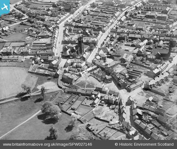
SPW027146 SCOTLAND (1929). Bathgate, general view, showing Bathgate High Church and Mid Street. An oblique aerial photograph taken facing south-east.
© Copyright OpenStreetMap contributors and licensed by the OpenStreetMap Foundation. 2026. Cartography is licensed as CC BY-SA.
Nearby Images (4)
SPW027146

SAR029079

SAR029080

SPW027151

Details
| Title | [SPW027146] Bathgate, general view, showing Bathgate High Church and Mid Street. An oblique aerial photograph taken facing south-east. |
| Reference | SPW027146 |
| Date | 1929 |
| Link | NRHE Collection item 1256721 |
| Place name | |
| Parish | BATHGATE |
| District | WEST LOTHIAN |
| Country | SCOTLAND |
| Easting / Northing | 297478, 669146 |
| Longitude / Latitude | -3.6400303701494, 55.904525013022 |
| National Grid Reference | NS975691 |
Pins

whitburnbear |
Thursday 13th of February 2014 07:53:42 AM | |
|
t steven |
Tuesday 23rd of October 2012 09:11:09 PM |