
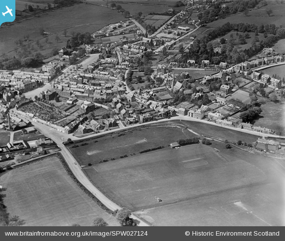
SPW027124 SCOTLAND (1929). Moffat, general view, showing High Street and Burnside. An oblique aerial photograph taken facing north-west.
© Copyright OpenStreetMap contributors and licensed by the OpenStreetMap Foundation. 2026. Cartography is licensed as CC BY-SA.
Nearby Images (5)
SPW027124

SPW027127

SPW027126

SPW027125

SPW027128

Details
| Title | [SPW027124] Moffat, general view, showing High Street and Burnside. An oblique aerial photograph taken facing north-west. |
| Reference | SPW027124 |
| Date | 1929 |
| Link | NRHE Collection item 1256643 |
| Place name | |
| Parish | MOFFAT |
| District | ANNANDALE AND ESKDALE |
| Country | SCOTLAND |
| Easting / Northing | 308628, 605306 |
| Longitude / Latitude | -3.440545835001, 55.333269017907 |
| National Grid Reference | NT086053 |
Pins
Be the first to add a comment to this image!
User Comment Contributions
I have happy memories of partaking of a High Tea in Moffat nearly forty years ago. We had fish and chips and sandwiches and cakes and a pot of tea. I think it would be too much for me these day. |

Class31 |
Saturday 25th of May 2013 03:31:32 PM |