
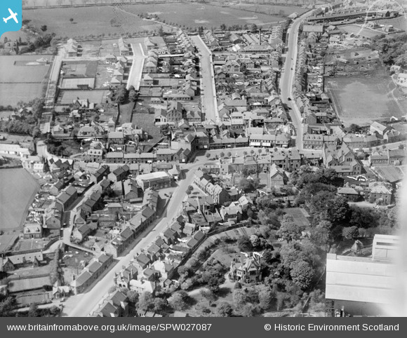
SPW027087 SCOTLAND (1929). Penicuik, general view, showing High Street, John Street and Woodslea. An oblique aerial photograph taken facing north.
© Copyright OpenStreetMap contributors and licensed by the OpenStreetMap Foundation. 2026. Cartography is licensed as CC BY-SA.
Nearby Images (5)
SPW027087

SPW027088

SPW042191

SPW027089

SPW042190

Details
| Title | [SPW027087] Penicuik, general view, showing High Street, John Street and Woodslea. An oblique aerial photograph taken facing north. |
| Reference | SPW027087 |
| Date | 1929 |
| Link | NRHE Collection item 1256606 |
| Place name | |
| Parish | PENICUIK (MIDLOTHIAN) |
| District | MIDLOTHIAN |
| Country | SCOTLAND |
| Easting / Northing | 323535, 659890 |
| Longitude / Latitude | -3.2207138917231, 55.826214726056 |
| National Grid Reference | NT235599 |
