
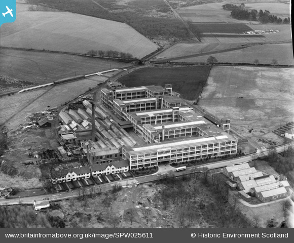
SPW025611 SCOTLAND (1929). Arrol-Aster Car Factory, Heathhall, Dumfries. An oblique aerial photograph taken facing north.
© Copyright OpenStreetMap contributors and licensed by the OpenStreetMap Foundation. 2026. Cartography is licensed as CC BY-SA.
Nearby Images (12)
SPW025611

SPW025612

SPW025613

SPW025614

SPW025615

SPW025616

SPW025617

SPW025621

SPW025622

SPW025623

SPW025624

SPW025625

Details
| Title | [SPW025611] Arrol-Aster Car Factory, Heathhall, Dumfries. An oblique aerial photograph taken facing north. |
| Reference | SPW025611 |
| Date | 1929 |
| Link | NRHE Collection item 1256573 |
| Place name | |
| Parish | DUMFRIES |
| District | NITHSDALE |
| Country | SCOTLAND |
| Easting / Northing | 298937, 579018 |
| Longitude / Latitude | -3.5838612807807, 55.095216000624 |
| National Grid Reference | NX989790 |
Pins

Mike Holder |
Monday 22nd of February 2021 01:48:28 PM |