
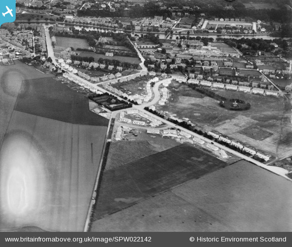
SPW022142 SCOTLAND (1928). Inverness, general view, showing Royal Northern Infirmary and Bellfield Park. An oblique aerial photograph taken facing east.
© Copyright OpenStreetMap contributors and licensed by the OpenStreetMap Foundation. 2025. Cartography is licensed as CC BY-SA.
Nearby Images (2)
SPW022142

SAR016702
 Inverness and Bona, Inverness-Shire, Scotland. An oblique aerial photograph taken facing North. This image was marked by AeroPictorial Ltd for photo editing.")
Details
| Title | [SPW022142] Inverness, general view, showing Royal Northern Infirmary and Bellfield Park. An oblique aerial photograph taken facing east. |
| Reference | SPW022142 |
| Date | 1928 |
| Link | NRHE Collection item 1256511 |
| Place name | |
| Parish | INVERNESS AND BONA |
| District | INVERNESS |
| Country | SCOTLAND |
| Easting / Northing | 265800, 844800 |
| Longitude / Latitude | -4.2381012539131, 57.473790325132 |
| National Grid Reference | NH658448 |
Pins
Be the first to add a comment to this image!