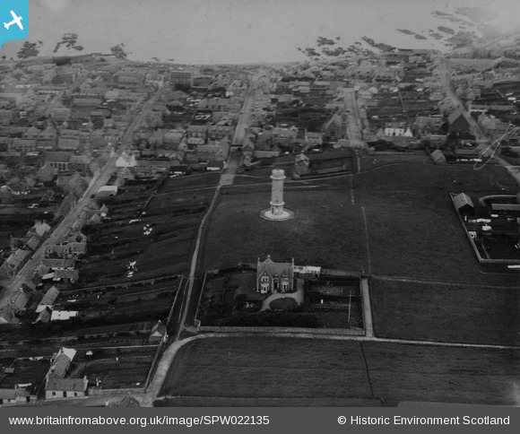
SPW022135 SCOTLAND (1928). Macduff, general view, showing War Memorial and The Knowes. An oblique aerial photograph taken facing north-east.
© Copyright OpenStreetMap contributors and licensed by the OpenStreetMap Foundation. 2025. Cartography is licensed as CC BY-SA.
Details
| Title | [SPW022135] Macduff, general view, showing War Memorial and The Knowes. An oblique aerial photograph taken facing north-east. |
| Reference | SPW022135 |
| Date | 1928 |
| Link | NRHE Collection item 1256505 |
| Place name | |
| Parish | GAMRIE |
| District | BANFF AND BUCHAN |
| Country | SCOTLAND |
| Easting / Northing | 370464, 864314 |
| Longitude / Latitude | -2.4951616652334, 57.667982140201 |
| National Grid Reference | NJ705643 |
Pins

Pault |
Tuesday 26th of June 2012 01:40:11 PM |
User Comment Contributions
I am VERY interested in Stanley West's comments on The Park and Duff Villa. If he sees this, could he please contact me via this site. |

Angelcat |
Tuesday 28th of August 2012 05:52:14 PM |

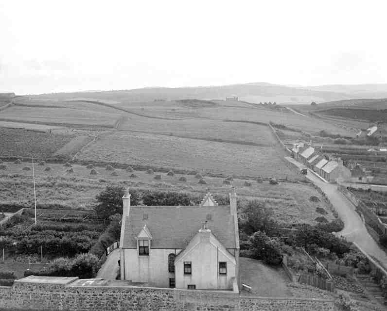
The house in the foreground was known as The Park (now the Park Hotel). It was my mother's family home from 1926 to 1958; I spent all the holidays there from 1936-1950. I am uploading a photo taken in the esarly 1930s from the top of the war memorial - exactly from the opposite direction to your one taken in 1928. It is so sad to see it as is now is: the garden is almost entirely tarmac car park, there is a rather hideous house built near the former entrance, the house has a hideous extension (bar) and the whole area is covered with housing. |

Angelcat |
Saturday 14th of July 2012 10:07:28 AM |
THE "PARK" WAS BUILT BY, AND FOR, TWO BROTHERS WHO HAD A BUILDING BUSINESS. DUFF VILLA IN THE UPPER PART OF DUFF STREET IS EXACTLY THE SAME BUILD |

stanley west |
Saturday 14th of July 2012 10:07:28 AM |


![[SPW022135] Macduff, general view, showing War Memorial and The Knowes. An oblique aerial photograph taken facing north-east.](http://britainfromabove.org.uk/sites/all/libraries/aerofilms-images/public/100x100/SPW/022/SPW022135.jpg)
![[SAR033572] General View Gamrie, Banff, Scotland. An oblique aerial photograph taken facing North.](http://britainfromabove.org.uk/sites/all/libraries/aerofilms-images/public/100x100/SAR/033/SAR033572.jpg)
![[SPW040540] Macduff, general view, showing Shore Street and Duff Street. An oblique aerial photograph taken facing east. This image has been produced from a print.](http://britainfromabove.org.uk/sites/all/libraries/aerofilms-images/public/100x100/SPW/040/SPW040540.jpg)