
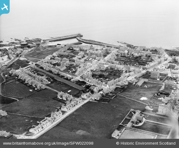
SPW022098 SCOTLAND (1928). Banff, general view, showing North Pier and St Catherine Street. An oblique aerial photograph taken facing east.
© Copyright OpenStreetMap contributors and licensed by the OpenStreetMap Foundation. 2025. Cartography is licensed as CC BY-SA.
Nearby Images (6)
SPW022098

SPW022101

SPW040547

SPW040543

SPW040546

SPW022100

Details
| Title | [SPW022098] Banff, general view, showing North Pier and St Catherine Street. An oblique aerial photograph taken facing east. |
| Reference | SPW022098 |
| Date | 1928 |
| Link | NRHE Collection item 1256473 |
| Place name | |
| Parish | BANFF |
| District | BANFF AND BUCHAN |
| Country | SCOTLAND |
| Easting / Northing | 368706, 864421 |
| Longitude / Latitude | -2.5246464835419, 57.668824563131 |
| National Grid Reference | NJ687644 |
Pins
Be the first to add a comment to this image!