
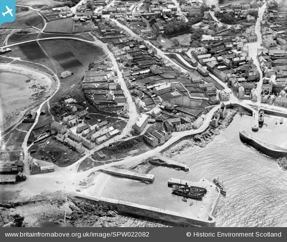
SPW022082 SCOTLAND (1928). Portsoy, general view, showing New Harbour, Shore Street and School Hendry Street. An oblique aerial photograph taken facing south.
© Copyright OpenStreetMap contributors and licensed by the OpenStreetMap Foundation. 2025. Cartography is licensed as CC BY-SA.
Nearby Images (2)
SPW022082

SPW022084

Details
| Title | [SPW022082] Portsoy, general view, showing New Harbour, Shore Street and School Hendry Street. An oblique aerial photograph taken facing south. |
| Reference | SPW022082 |
| Date | 1928 |
| Link | NRHE Collection item 1256460 |
| Place name | |
| Parish | FORDYCE |
| District | BANFF AND BUCHAN |
| Country | SCOTLAND |
| Easting / Northing | 359068, 866353 |
| Longitude / Latitude | -2.6865446161246, 57.685406069821 |
| National Grid Reference | NJ591664 |
Pins

MB |
Monday 1st of October 2012 06:13:14 PM | |
|
MB |
Monday 1st of October 2012 06:11:51 PM | |
|
MB |
Monday 1st of October 2012 06:08:19 PM | |
|
MB |
Monday 1st of October 2012 06:07:09 PM | |
|
MB |
Monday 1st of October 2012 06:06:02 PM | |
|
MB |
Monday 1st of October 2012 06:04:20 PM | |
|
MB |
Monday 1st of October 2012 06:03:28 PM | |
|
MB |
Monday 1st of October 2012 06:02:37 PM | |
|
MB |
Monday 1st of October 2012 06:01:43 PM | |
|
MB |
Monday 1st of October 2012 06:01:03 PM | |
|
MB |
Monday 1st of October 2012 06:00:22 PM | |
|
MB |
Monday 1st of October 2012 05:58:34 PM | |
|
MB |
Monday 1st of October 2012 05:44:20 PM |
User Comment Contributions
Can't quite make out the registrations of the two fishing vessels. The trawler with steam up might just come from Anstruther (AR): if so it is some distance from its home port. It's not an Aberdeen boat - they just carried 'A' then the number. The other vessel might be Banff registered (BF)? |
MB |
Monday 1st of October 2012 05:55:53 PM |