
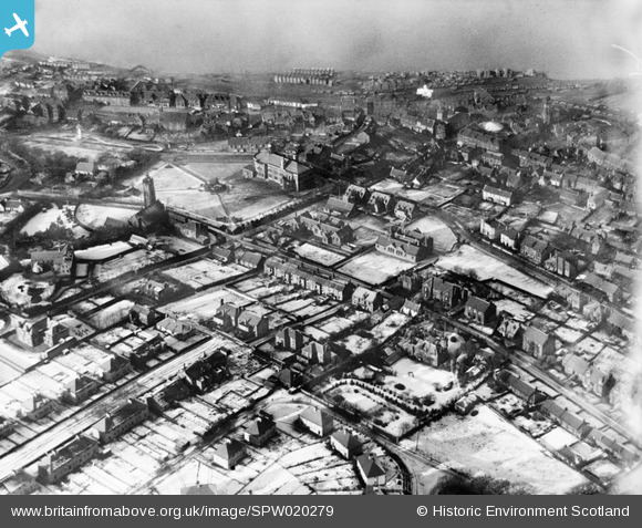
SPW020279 SCOTLAND (1928). Bo'ness, general view, showing Town Hall and Glebe Park. An oblique aerial photograph taken facing north-west.
© Copyright OpenStreetMap contributors and licensed by the OpenStreetMap Foundation. 2026. Cartography is licensed as CC BY-SA.
Nearby Images (4)
SPW020279

SPW027157

SPW027156

SPW027167

Details
| Title | [SPW020279] Bo'ness, general view, showing Town Hall and Glebe Park. An oblique aerial photograph taken facing north-west. |
| Reference | SPW020279 |
| Date | 1928 |
| Link | NRHE Collection item 1256362 |
| Place name | |
| Parish | BO'NESS AND CARRIDEN |
| District | FALKIRK |
| Country | SCOTLAND |
| Easting / Northing | 299929, 681441 |
| Longitude / Latitude | -3.6054053418547, 56.015477974799 |
| National Grid Reference | NS999814 |
Pins

Chells809 |
Tuesday 22nd of August 2017 09:55:35 PM |