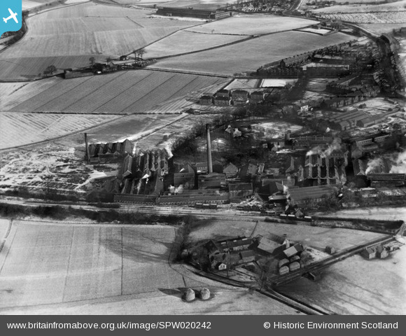
SPW020242 SCOTLAND (1928). Thornliebank Mill, Spiersbridge Road, Thornliebank. An oblique aerial photograph taken facing north-east.
© Copyright OpenStreetMap contributors and licensed by the OpenStreetMap Foundation. 2025. Cartography is licensed as CC BY-SA.
Details
| Title | [SPW020242] Thornliebank Mill, Spiersbridge Road, Thornliebank. An oblique aerial photograph taken facing north-east. |
| Reference | SPW020242 |
| Date | 1928 |
| Link | Canmore Collection item 1259258 |
| Place name | |
| Parish | EASTWOOD (EASTWOOD) |
| District | EASTWOOD |
| Country | SCOTLAND |
| Easting / Northing | 254651, 659319 |
| Longitude / Latitude | -4.3193245010891, 55.805269344712 |
| National Grid Reference | NS547593 |
Pins
Be the first to add a comment to this image!


![[SPW020241] Thornliebank Mill, Spiersbridge Road, Thornliebank. An oblique aerial photograph taken facing north-east.](http://britainfromabove.org.uk/sites/all/libraries/aerofilms-images/public/100x100/SPW/020/SPW020241.jpg)
![[SPW020242] Thornliebank Mill, Spiersbridge Road, Thornliebank. An oblique aerial photograph taken facing north-east.](http://britainfromabove.org.uk/sites/all/libraries/aerofilms-images/public/100x100/SPW/020/SPW020242.jpg)
![[SPW053494] General view, Arden, Eastwood, Lanarkshire, Scotland, 1937. An oblique aerial photograph, taken facing south.](http://britainfromabove.org.uk/sites/all/libraries/aerofilms-images/public/100x100/SPW/053/SPW053494.jpg)