
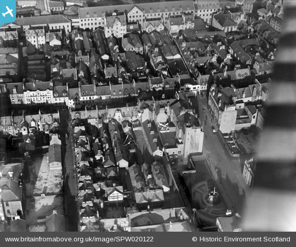
SPW020122 SCOTLAND (1927). Perth, general view, showing High Street and St John's Square. An oblique aerial photograph taken facing north.
© Copyright OpenStreetMap contributors and licensed by the OpenStreetMap Foundation. 2026. Cartography is licensed as CC BY-SA.
Nearby Images (23)
SPW020122

SAW026584

SPW020089

SPW020090

SPW020091

SPW020092

SPW020093

SPW020094

SPW020095

SPW020104

SAR017619

SAR017620

SPW040516

SPW020126

SPW020121

SAW022531

SAR018932

SAR018933

SAW022534

SAW022536

SAW022530

SAW022532

SAW022533

Details
| Title | [SPW020122] Perth, general view, showing High Street and St John's Square. An oblique aerial photograph taken facing north. |
| Reference | SPW020122 |
| Date | 1927 |
| Link | NRHE Collection item 1246415 |
| Place name | |
| Parish | PERTH |
| District | PERTH AND KINROSS |
| Country | SCOTLAND |
| Easting / Northing | 311791, 723613 |
| Longitude / Latitude | -3.4292006010477, 56.396624845717 |
| National Grid Reference | NO118236 |
Pins
Be the first to add a comment to this image!