
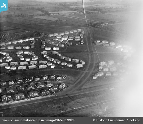
SPW019924 SCOTLAND (1927). Dundee, general view, showing Carlochie Place and Greendykes Road. An oblique aerial photograph taken facing north.
© Copyright OpenStreetMap contributors and licensed by the OpenStreetMap Foundation. 2026. Cartography is licensed as CC BY-SA.
Nearby Images (2)
SPW019924

SPW042542

Details
| Title | [SPW019924] Dundee, general view, showing Carlochie Place and Greendykes Road. An oblique aerial photograph taken facing north. |
| Reference | SPW019924 |
| Date | 1927 |
| Link | NRHE Collection item 1246328 |
| Place name | |
| Parish | DUNDEE (DUNDEE, CITY OF) |
| District | CITY OF DUNDEE |
| Country | SCOTLAND |
| Easting / Northing | 342888, 731411 |
| Longitude / Latitude | -2.927151635445, 56.471463366723 |
| National Grid Reference | NO429314 |
Pins

ronwkidd |
Tuesday 2nd of August 2016 09:08:31 PM | |

Class31 |
Thursday 18th of April 2013 08:33:15 AM | |
|
Class31 |
Thursday 18th of April 2013 08:32:36 AM | |
|
Class31 |
Thursday 18th of April 2013 08:32:01 AM | |
|
Class31 |
Thursday 18th of April 2013 08:31:02 AM | |
|
Class31 |
Thursday 18th of April 2013 08:30:21 AM | |
DON'T THINK SO! RAILWAY IS AT BOTTOM OF PIC, SO CARLOCHIE PLACE IS ON THE OPPOSITE SIDE. HOWEVER THE CHURCH FURTHER UP GREENDYKES ROAD IS MISSING! MY COUSINS WERE MARRIED THERE - AND I WAS THERE!! |
ronwkidd |
Tuesday 2nd of August 2016 09:04:02 PM |