
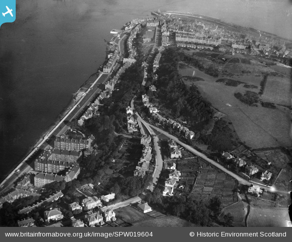
SPW019604 SCOTLAND (1927). Gourock, general view, showing Tower Hill and Barrhill Road. An oblique aerial photograph taken facing north-east.
© Copyright OpenStreetMap contributors and licensed by the OpenStreetMap Foundation. 2025. Cartography is licensed as CC BY-SA.
Nearby Images (3)
SPW019604

SAR018771

SPW019605

Details
| Title | [SPW019604] Gourock, general view, showing Tower Hill and Barrhill Road. An oblique aerial photograph taken facing north-east. |
| Reference | SPW019604 |
| Date | 1927 |
| Link | Canmore Collection item 1246325 |
| Place name | |
| Parish | INVERKIP |
| District | INVERCLYDE |
| Country | SCOTLAND |
| Easting / Northing | 223744, 677378 |
| Longitude / Latitude | -4.823644175585, 55.957067368703 |
| National Grid Reference | NS237774 |
Pins
 Linbrad |
Friday 11th of August 2017 03:29:37 PM | |
angela |
Wednesday 13th of January 2016 09:50:32 AM | |
Tam |
Tuesday 19th of March 2013 08:02:18 AM | |
Tam |
Tuesday 19th of March 2013 07:56:13 AM | |
Tam |
Tuesday 19th of March 2013 07:54:20 AM | |
Tam |
Tuesday 19th of March 2013 07:53:50 AM | |
Tam |
Tuesday 19th of March 2013 07:53:04 AM | |
Tam |
Tuesday 19th of March 2013 07:52:16 AM | |
Tam |
Tuesday 19th of March 2013 07:51:37 AM |