
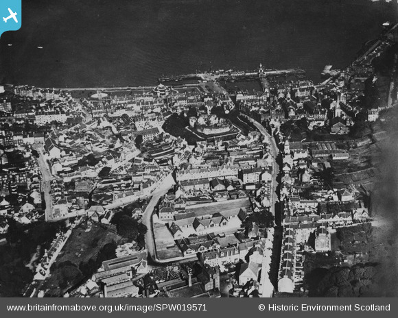
SPW019571 SCOTLAND (1927). Rothesay, general view, showing Rothesay Castle and Union Street, Isle of Bute. An oblique aerial photograph taken facing north. This image has been produced from a print.
© Copyright OpenStreetMap contributors and licensed by the OpenStreetMap Foundation. 2026. Cartography is licensed as CC BY-SA.
Nearby Images (4)
SPW019571

SAW017837

SPW019570

SAW017839

Details
| Title | [SPW019571] Rothesay, general view, showing Rothesay Castle and Union Street, Isle of Bute. An oblique aerial photograph taken facing north. This image has been produced from a print. |
| Reference | SPW019571 |
| Date | 1927 |
| Link | NRHE Collection item 1315390 |
| Place name | |
| Parish | ROTHESAY |
| District | ARGYLL AND BUTE |
| Country | SCOTLAND |
| Easting / Northing | 208761, 664509 |
| Longitude / Latitude | -5.0542106369845, 55.835864100569 |
| National Grid Reference | NS088645 |
Pins

Mrpaulj |
Thursday 1st of December 2016 09:52:33 PM | |
|
Mrpaulj |
Thursday 1st of December 2016 09:52:04 PM | |
|
Mrpaulj |
Thursday 1st of December 2016 09:51:34 PM | |
|
Mrpaulj |
Thursday 1st of December 2016 09:50:51 PM | |
|
Mrpaulj |
Thursday 1st of December 2016 09:50:23 PM | |
|
Mrpaulj |
Thursday 1st of December 2016 09:49:40 PM |