
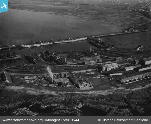
SPW019544 SCOTLAND (1927). Troon Harbour and North Sands. An oblique aerial photograph taken facing east. This image has been produced from a print.
© Copyright OpenStreetMap contributors and licensed by the OpenStreetMap Foundation. 2025. Cartography is licensed as CC BY-SA.
Nearby Images (2)
SPW019544

SPW019546

Details
| Title | [SPW019544] Troon Harbour and North Sands. An oblique aerial photograph taken facing east. This image has been produced from a print. |
| Reference | SPW019544 |
| Date | 1927 |
| Link | NRHE Collection item 1315383 |
| Place name | |
| Parish | MARITIME - SOUTH AYRSHIRE |
| District | MARITIME |
| Country | SCOTLAND |
| Easting / Northing | 230900, 631400 |
| Longitude / Latitude | -4.680677242685, 55.546932936012 |
| National Grid Reference | NS309314 |
Pins
Be the first to add a comment to this image!