
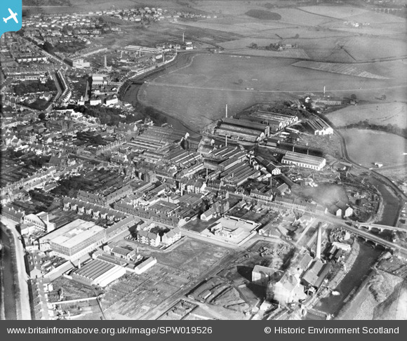
SPW019526 SCOTLAND (1927). Kilmarnock, general view, showing Glencairn works. An oblique aerial photograph taken facing east.
© Copyright OpenStreetMap contributors and licensed by the OpenStreetMap Foundation. 2026. Cartography is licensed as CC BY-SA.
Nearby Images (10)
SAR014725

SAR014726

SPW019526

SPW052973

SPW052974

SPW052975

SPW052976

SPW052977

SPW052978

SPW052979

Details
| Title | [SPW019526] Kilmarnock, general view, showing Glencairn works. An oblique aerial photograph taken facing east. |
| Reference | SPW019526 |
| Date | 1927 |
| Link | NRHE Collection item 1256150 |
| Place name | |
| Parish | KILMARNOCK |
| District | KILMARNOCK AND LOUDOUN |
| Country | SCOTLAND |
| Easting / Northing | 242778, 636833 |
| Longitude / Latitude | -4.4956804650333, 55.599681911945 |
| National Grid Reference | NS428368 |
Pins

Tritium |
Friday 15th of March 2013 05:56:50 PM | |
|
Tritium |
Friday 15th of March 2013 05:54:59 PM | |
|
Tritium |
Friday 15th of March 2013 05:52:06 PM | |
|
Tritium |
Friday 15th of March 2013 05:50:03 PM | |
|
cell |
Monday 23rd of July 2012 08:40:53 PM |