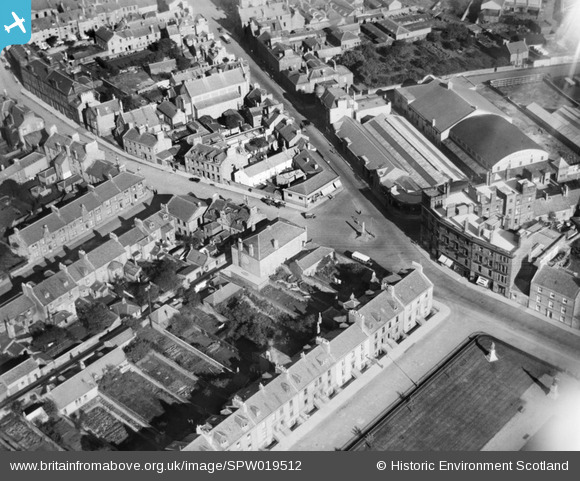
SPW019512 SCOTLAND (1927). Sandgate, Fort Street and Wellington Square, Ayr. An oblique aerial photograph taken facing north-east.
© Copyright OpenStreetMap contributors and licensed by the OpenStreetMap Foundation. 2025. Cartography is licensed as CC BY-SA.
Details
| Title | [SPW019512] Sandgate, Fort Street and Wellington Square, Ayr. An oblique aerial photograph taken facing north-east. |
| Reference | SPW019512 |
| Date | 1927 |
| Link | NRHE Collection item 1246287 |
| Place name | |
| Parish | AYR |
| District | KYLE AND CARRICK |
| Country | SCOTLAND |
| Easting / Northing | 233508, 621834 |
| Longitude / Latitude | -4.6336408634034, 55.461956285365 |
| National Grid Reference | NS335218 |
Pins
User Comment Contributions
greens palyhouse on the right but don't know what is at the back of it joined on? |

macbee1910 |
Wednesday 25th of July 2012 12:58:44 PM |


![[SPW019512] Sandgate, Fort Street and Wellington Square, Ayr. An oblique aerial photograph taken facing north-east.](http://britainfromabove.org.uk/sites/all/libraries/aerofilms-images/public/100x100/SPW/019/SPW019512.jpg)
![[SPW019515] Wellington Square, Ayr. An oblique aerial photograph taken facing north-east.](http://britainfromabove.org.uk/sites/all/libraries/aerofilms-images/public/100x100/SPW/019/SPW019515.jpg)
![[SPW051055] Ayr, general view, showing Low Green and Ayr Racecourse. An oblique aerial photograph taken facing east.](http://britainfromabove.org.uk/sites/all/libraries/aerofilms-images/public/100x100/SPW/051/SPW051055.jpg)
