
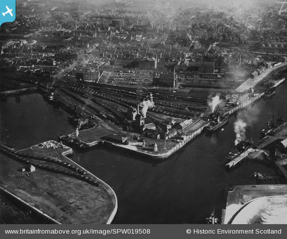
SPW019508 SCOTLAND (1927). Ayr, general view, showing Ayr Harbour and York Street. An oblique aerial photograph taken facing east. This image has been produced from a print.
© Copyright OpenStreetMap contributors and licensed by the OpenStreetMap Foundation. 2025. Cartography is licensed as CC BY-SA.
Nearby Images (3)
SPW019508

SPW019513

SPW051058

Details
| Title | [SPW019508] Ayr, general view, showing Ayr Harbour and York Street. An oblique aerial photograph taken facing east. This image has been produced from a print. |
| Reference | SPW019508 |
| Date | 1927 |
| Link | NRHE Collection item 1315379 |
| Place name | |
| Parish | AYR |
| District | KYLE AND CARRICK |
| Country | SCOTLAND |
| Easting / Northing | 233287, 622649 |
| Longitude / Latitude | -4.637621263482, 55.469197322709 |
| National Grid Reference | NS333226 |
Pins

MB |
Sunday 1st of December 2013 10:04:47 AM |