
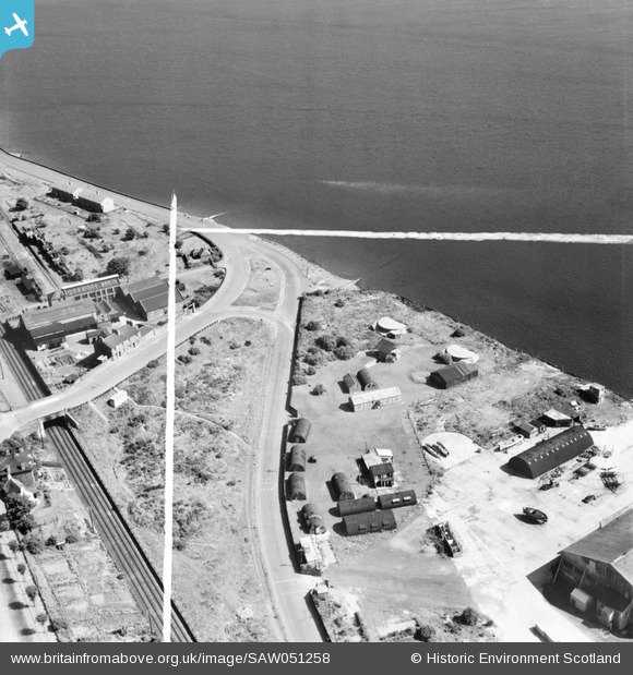
SAW051258 SCOTLAND (1953). Former Seaplane Base, Stannergate Road, Dundee. An oblique aerial photograph taken facing east. This image has been produced from a crop marked negative.
© Copyright OpenStreetMap contributors and licensed by the OpenStreetMap Foundation. 2026. Cartography is licensed as CC BY-SA.
Nearby Images (10)
SAW051256

SAW051258

SAW051262

SAW051253

SAW051255

SAW051260

SAW051261

SAW051252

SAW051254

SAW051259

Details
| Title | [SAW051258] Former Seaplane Base, Stannergate Road, Dundee. An oblique aerial photograph taken facing east. This image has been produced from a crop marked negative. |
| Reference | SAW051258 |
| Date | 1953 |
| Link | NRHE Collection item 1297919 |
| Place name | |
| Parish | DUNDEE (DUNDEE, CITY OF) |
| District | CITY OF DUNDEE |
| Country | SCOTLAND |
| Easting / Northing | 343380, 730880 |
| Longitude / Latitude | -2.9190504582844, 56.466752284332 |
| National Grid Reference | NO434309 |
Pins

Matt Aldred edob.mattaldred.com |
Monday 29th of March 2021 01:29:18 PM | |
|
Matt Aldred edob.mattaldred.com |
Monday 29th of March 2021 01:26:49 PM | |

Billy Turner |
Thursday 28th of January 2016 08:42:37 PM |