
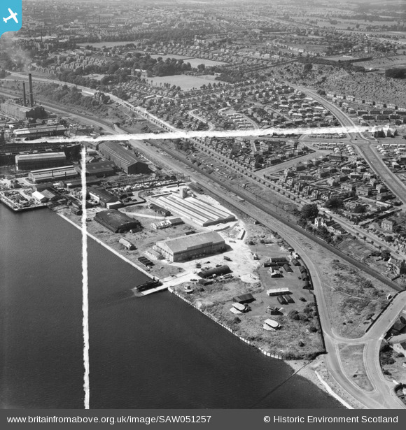
SAW051257 SCOTLAND (1953). Dundee, general view, showing former Seaplane Base, Stannergate Road and Craigie Avenue. An oblique aerial photograph taken facing north-west. This image has been produced from a crop marked negative.
© Copyright OpenStreetMap contributors and licensed by the OpenStreetMap Foundation. 2026. Cartography is licensed as CC BY-SA.
Nearby Images (8)
SAW051257

SAW051252

SAW051254

SAW051259

SAW051253

SAW051255

SAW051260

SAW051261

Details
| Title | [SAW051257] Dundee, general view, showing former Seaplane Base, Stannergate Road and Craigie Avenue. An oblique aerial photograph taken facing north-west. This image has been produced from a crop marked negative. |
| Reference | SAW051257 |
| Date | 1953 |
| Link | NRHE Collection item 1297918 |
| Place name | |
| Parish | DUNDEE (DUNDEE, CITY OF) |
| District | CITY OF DUNDEE |
| Country | SCOTLAND |
| Easting / Northing | 343100, 731000 |
| Longitude / Latitude | -2.9236208979359, 56.467796632034 |
| National Grid Reference | NO431310 |
Pins

Matt Aldred edob.mattaldred.com |
Monday 29th of March 2021 01:28:36 PM | |
|
Matt Aldred edob.mattaldred.com |
Monday 29th of March 2021 01:26:27 PM | |
|
Matt Aldred edob.mattaldred.com |
Monday 29th of March 2021 01:24:36 PM | |

ronwkidd |
Tuesday 2nd of August 2016 10:36:58 PM | |
|
ronwkidd |
Tuesday 2nd of August 2016 10:35:54 PM | |

Billy Turner |
Thursday 28th of January 2016 08:49:07 PM | |
|
irmurray |
Thursday 24th of April 2014 01:17:14 PM | |
|
irmurray |
Thursday 24th of April 2014 01:13:00 PM | |

JMB |
Friday 14th of December 2012 12:48:38 AM |
User Comment Contributions

Coast Artillery Battery, Dundee. |
cptpies |
Thursday 19th of December 2013 02:42:29 PM |