
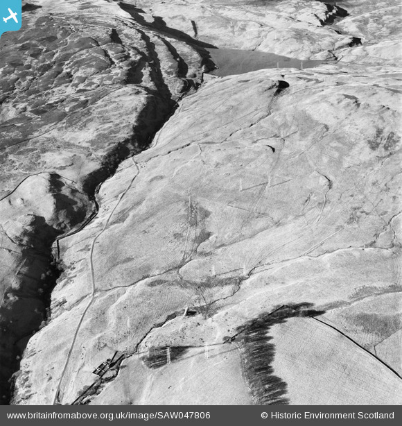
SAW047806 SCOTLAND (1952). Greenside Reservoir and Loch Humphrey Burn, Kilpatrick Hills. An oblique aerial photograph taken facing north-west.
© Copyright OpenStreetMap contributors and licensed by the OpenStreetMap Foundation. 2025. Cartography is licensed as CC BY-SA.
Nearby Images (2)
SAW047806

SAW047805

Details
| Title | [SAW047806] Greenside Reservoir and Loch Humphrey Burn, Kilpatrick Hills. An oblique aerial photograph taken facing north-west. |
| Reference | SAW047806 |
| Date | 1952 |
| Link | NRHE Collection item 1297811 |
| Place name | |
| Parish | OLD KILPATRICK (CLYDEBANK) |
| District | CLYDEBANK |
| Country | SCOTLAND |
| Easting / Northing | 248200, 674800 |
| Longitude / Latitude | -4.4308333422279, 55.942272399811 |
| National Grid Reference | NS482748 |
Pins
Be the first to add a comment to this image!