
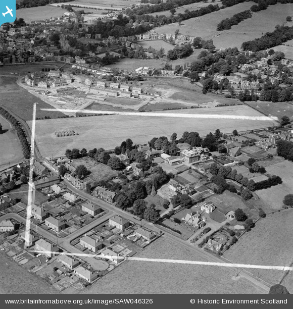
SAW046326 SCOTLAND (1952). Moffat, general view, showing Warriston School Holmpark, Ballplay Road and Park Circle. An oblique aerial photograph taken facing north-west. This image has been produced from a crop marked negative.
© Copyright OpenStreetMap contributors and licensed by the OpenStreetMap Foundation. 2026. Cartography is licensed as CC BY-SA.
Nearby Images (6)
SAW046322

SAW046323

SAW046324

SAW046325

SAW046326

SAW046327

Details
| Title | [SAW046326] Moffat, general view, showing Warriston School Holmpark, Ballplay Road and Park Circle. An oblique aerial photograph taken facing north-west. This image has been produced from a crop marked negative. |
| Reference | SAW046326 |
| Date | 1952 |
| Link | NRHE Collection item 1297732 |
| Place name | |
| Parish | MOFFAT |
| District | ANNANDALE AND ESKDALE |
| Country | SCOTLAND |
| Easting / Northing | 309259, 605177 |
| Longitude / Latitude | -3.4305593829117, 55.332226936941 |
| National Grid Reference | NT093052 |
Pins

Roger |
Tuesday 31st of May 2022 01:34:35 PM |