
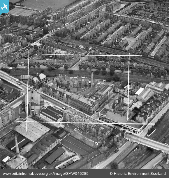
SAW046289 SCOTLAND (1952). Edinburgh, general view, showing Waddie and Co. Ltd. St Stephen's Works, Slateford Road and Shandon Street. An oblique aerial photograph taken facing east. This image has been produced from a crop marked negative.
© Copyright OpenStreetMap contributors and licensed by the OpenStreetMap Foundation. 2026. Cartography is licensed as CC BY-SA.
Nearby Images (17)
SAW046289

SAW046290

SAW046291

SAW046294

SAW046295

SAW046663

SAW046664

SAW046665

SAW046666

SAW046667

SAW046668

SAW046669

SAW046670

SAW046671

SAW046672

SAW046292

SAW046293

Details
| Title | [SAW046289] Edinburgh, general view, showing Waddie and Co. Ltd. St Stephen's Works, Slateford Road and Shandon Street. An oblique aerial photograph taken facing east. This image has been produced from a crop marked negative. |
| Reference | SAW046289 |
| Date | 1952 |
| Link | NRHE Collection item 1297702 |
| Place name | |
| Parish | EDINBURGH (EDINBURGH, CITY OF) |
| District | CITY OF EDINBURGH |
| Country | SCOTLAND |
| Easting / Northing | 322988, 671826 |
| Longitude / Latitude | -3.2328380849461, 55.93335898686 |
| National Grid Reference | NT230718 |
Pins
Be the first to add a comment to this image!