
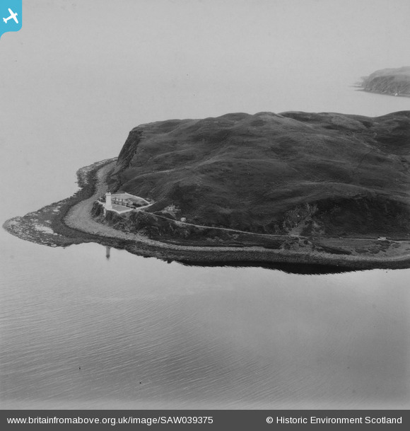
SAW039375 SCOTLAND (1951). Island Davaar and Davaar Lighthouse. An oblique aerial photograph taken facing south-east. This image has been produced from a print.
© Copyright OpenStreetMap contributors and licensed by the OpenStreetMap Foundation. 2026. Cartography is licensed as CC BY-SA.
Nearby Images (2)
SAW039375

SAW039376

Details
| Title | [SAW039375] Island Davaar and Davaar Lighthouse. An oblique aerial photograph taken facing south-east. This image has been produced from a print. |
| Reference | SAW039375 |
| Date | 1951 |
| Link | NRHE Collection item 1315294 |
| Place name | |
| Parish | CAMPBELTOWN |
| District | ARGYLL AND BUTE |
| Country | SCOTLAND |
| Easting / Northing | 175994, 620605 |
| Longitude / Latitude | -5.5407377713455, 55.428002391285 |
| National Grid Reference | NR760206 |
Pins

jrussill |
Tuesday 2nd of June 2015 04:53:45 PM |
User Comment Contributions

COASTAL OBSERVATION POST: S0006287 |
jrussill |
Tuesday 2nd of June 2015 04:54:51 PM |