
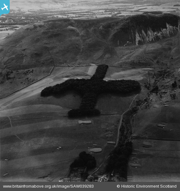
SAW039283 SCOTLAND (1951). Lothianburn Golf Course and Caerketton Hill, Edinburgh. An oblique aerial photograph taken facing south. This image has been produced from a print.
© Copyright OpenStreetMap contributors and licensed by the OpenStreetMap Foundation. 2026. Cartography is licensed as CC BY-SA.
Details
| Title | [SAW039283] Lothianburn Golf Course and Caerketton Hill, Edinburgh. An oblique aerial photograph taken facing south. This image has been produced from a print. |
| Reference | SAW039283 |
| Date | 1951 |
| Link | NRHE Collection item 1315269 |
| Place name | |
| Parish | EDINBURGH (EDINBURGH, CITY OF) |
| District | CITY OF EDINBURGH |
| Country | SCOTLAND |
| Easting / Northing | 324153, 667083 |
| Longitude / Latitude | -3.2128620766144, 55.890933713974 |
| National Grid Reference | NT242671 |
Pins
Be the first to add a comment to this image!
User Comment Contributions
Should be at NT239668 or thereabouts. |

Alan McFarlane |
Tuesday 21st of May 2013 02:47:26 PM |

Shows a scene to the south of Edinburgh but located far away... |
Alan McFarlane |
Tuesday 21st of May 2013 02:43:21 PM |