
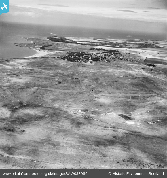
SAW038966 SCOTLAND (1951). Gullane Golf Course. An oblique aerial photograph taken facing north-east.
© Copyright OpenStreetMap contributors and licensed by the OpenStreetMap Foundation. 2026. Cartography is licensed as CC BY-SA.
Details
| Title | [SAW038966] Gullane Golf Course. An oblique aerial photograph taken facing north-east. |
| Reference | SAW038966 |
| Date | 1951 |
| Link | NRHE Collection item 1269890 |
| Place name | |
| Parish | DIRLETON |
| District | EAST LOTHIAN |
| Country | SCOTLAND |
| Easting / Northing | 347000, 682000 |
| Longitude / Latitude | -2.8505067228103, 56.028016554005 |
| National Grid Reference | NT470820 |
Pins

redmist |
Sunday 9th of October 2022 09:17:54 PM | |
|
redmist |
Sunday 9th of October 2022 09:17:08 PM | |
|
redmist |
Sunday 9th of October 2022 09:16:09 PM | |
|
cptpies |
Friday 10th of January 2014 01:14:08 PM |
User Comment Contributions
WWII Anti Tank Blocks. |
cptpies |
Friday 10th of January 2014 01:14:33 PM |