
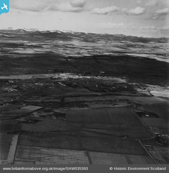
SAW035393 SCOTLAND (1951). Forfar, general view. An oblique aerial photograph taken facing north. This image has been produced from a print.
© Copyright OpenStreetMap contributors and licensed by the OpenStreetMap Foundation. 2026. Cartography is licensed as CC BY-SA.
Nearby Images (6)
SAW035393

SAW039081

SPW019964

SAR023882

SPW019987

SPW019966

Details
| Title | [SAW035393] Forfar, general view. An oblique aerial photograph taken facing north. This image has been produced from a print. |
| Reference | SAW035393 |
| Date | 1951 |
| Link | NRHE Collection item 1315219 |
| Place name | |
| Parish | FORFAR |
| District | ANGUS |
| Country | SCOTLAND |
| Easting / Northing | 345650, 750450 |
| Longitude / Latitude | -2.8863090667795, 56.642833835034 |
| National Grid Reference | NO457505 |
Pins
Be the first to add a comment to this image!