
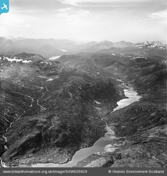
SAW029919 SCOTLAND (1950). Loch na Caoidhe and An Gorm-loch, Strathconon Forest. An oblique aerial photograph taken facing west.
© Copyright OpenStreetMap contributors and licensed by the OpenStreetMap Foundation. 2026. Cartography is licensed as CC BY-SA.
Nearby Images (3)
SAW029917

SAW029918

SAW029919

Details
| Title | [SAW029919] Loch na Caoidhe and An Gorm-loch, Strathconon Forest. An oblique aerial photograph taken facing west. |
| Reference | SAW029919 |
| Date | 1950 |
| Link | NRHE Collection item 1269567 |
| Place name | |
| Parish | URRAY (ROSS AND CROMARTY) |
| District | ROSS AND CROMARTY |
| Country | SCOTLAND |
| Easting / Northing | 222360, 844800 |
| Longitude / Latitude | -4.9615964880134, 57.458866102766 |
| National Grid Reference | NH224448 |
Pins

Class31 |
Thursday 26th of July 2012 02:30:48 PM | |
|
Class31 |
Thursday 26th of July 2012 02:30:11 PM | |
|
Class31 |
Thursday 26th of July 2012 02:27:40 PM | |
|
Class31 |
Thursday 26th of July 2012 02:23:32 PM | |
|
Class31 |
Thursday 26th of July 2012 02:22:31 PM | |
|
Class31 |
Thursday 26th of July 2012 02:21:51 PM |