
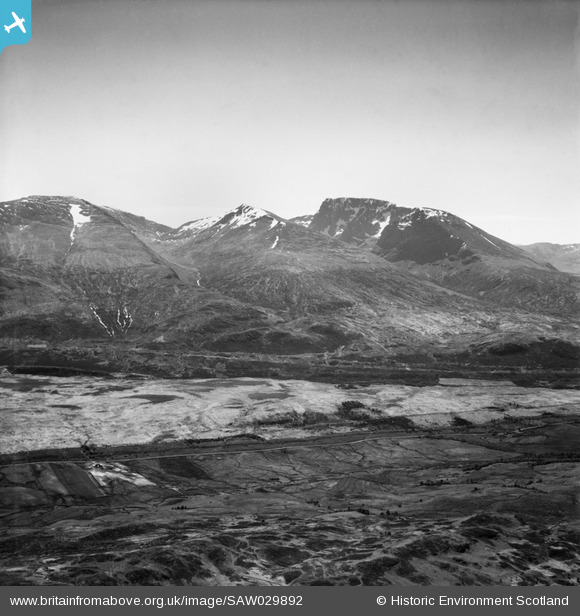
SAW029892 SCOTLAND (1950). Ben Nevis, Carn Beag Dearg and Aonach Mor. An oblique aerial photograph taken facing south.
© Copyright OpenStreetMap contributors and licensed by the OpenStreetMap Foundation. 2026. Cartography is licensed as CC BY-SA.
Details
| Title | [SAW029892] Ben Nevis, Carn Beag Dearg and Aonach Mor. An oblique aerial photograph taken facing south. |
| Reference | SAW029892 |
| Date | 1950 |
| Link | NRHE Collection item 1269540 |
| Place name | |
| Parish | KILMONIVAIG |
| District | LOCHABER |
| Country | SCOTLAND |
| Easting / Northing | 216520, 777840 |
| Longitude / Latitude | -5.0095745659127, 56.855813837028 |
| National Grid Reference | NN165778 |
Pins

JMB |
Tuesday 26th of June 2012 10:11:59 AM | |
|
JMB |
Tuesday 26th of June 2012 10:05:47 AM | |
This is probably the shelter at NN 1703 7919 with the three Carn an Doctair resting cairns visible nearby at the roadside. Neither site has a Canmore record. |
JMB |
Tuesday 26th of June 2012 10:24:29 AM |
User Comment Contributions

Traces of the WWII Decoy Site can just be made out. |
JMB |
Saturday 3rd of May 2014 10:33:13 PM |
|
At 4,409 feet (1344 metres) Ben Nevis is the highest mountain in Britain. Its geology is volcanic and catastrophic - it is essentially the remains of a large volcano that imploded in the Devonian period, leaving a mixture of granite and basalt which was then extensively eroded by glaciation. Ben Nevis attractes thousands of walkers every year, who take the well-worn 'tourist' path to its summit, and has some of the finest and most challenging summer and winter rock-climbing routes in the country. It has also been the site of many fatalities, owing to the complex topography of its summit plateau. |

AlMu |
Friday 7th of December 2012 11:58:55 AM |