
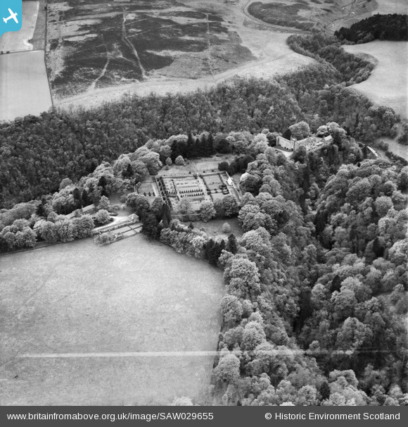
SAW029655 SCOTLAND (1950). Airlie Castle and Formal Garden. An oblique aerial photograph taken facing west. This image has been produced from a crop marked negative.
© Copyright OpenStreetMap contributors and licensed by the OpenStreetMap Foundation. 2025. Cartography is licensed as CC BY-SA.
Nearby Images (7)
SAW029655

SAW029651

SAW029652

SAW029653

SAW029654

SAW029656

SPW020195

Details
| Title | [SAW029655] Airlie Castle and Formal Garden. An oblique aerial photograph taken facing west. This image has been produced from a crop marked negative. |
| Reference | SAW029655 |
| Date | 1950 |
| Link | Canmore Collection item 1269507 |
| Place name | |
| Parish | AIRLIE |
| District | ANGUS |
| Country | SCOTLAND |
| Easting / Northing | 329425, 752111 |
| Longitude / Latitude | -3.1512982871578, 56.65559007648 |
| National Grid Reference | NO294521 |
Pins
Be the first to add a comment to this image!