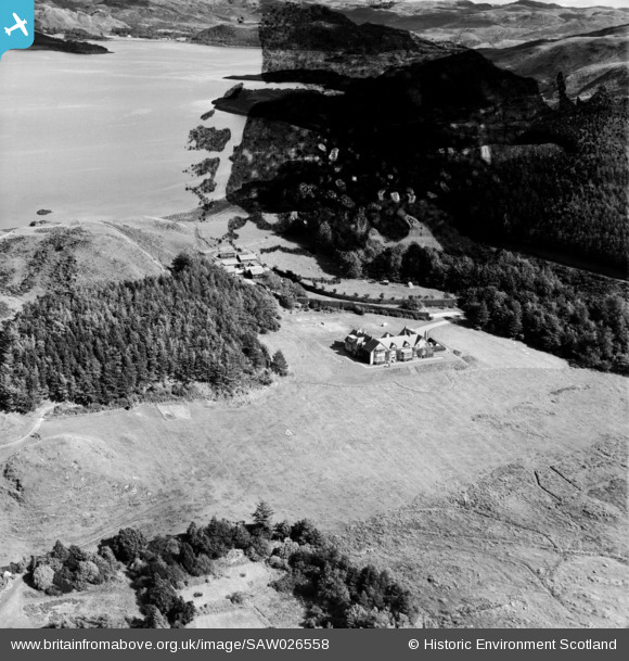
SAW026558 SCOTLAND (1949). Loch Melfort House and Arduaine Farm, Loch Melfort. An oblique aerial photograph taken facing north-east. This image has been produced from a damaged negative.
© Copyright OpenStreetMap contributors and licensed by the OpenStreetMap Foundation. 2024. Cartography is licensed as CC BY-SA.
Nearby Images (7)
Details
| Title | [SAW026558] Loch Melfort House and Arduaine Farm, Loch Melfort. An oblique aerial photograph taken facing north-east. This image has been produced from a damaged negative. |
| Reference | SAW026558 |
| Date | 1949 |
| Link | Canmore Collection item 1269397 |
| Place name | |
| Parish | KILNINVER AND KILMELFORD |
| District | ARGYLL AND BUTE |
| Country | SCOTLAND |
| Easting / Northing | 179820, 710390 |
| Longitude / Latitude | -5.5531464923832, 56.235023279285 |
| National Grid Reference | NM798104 |
Pins
Be the first to add a comment to this image!


![[SAW026558] Loch Melfort House and Arduaine Farm, Loch Melfort. An oblique aerial photograph taken facing north-east. This image has been produced from a damaged negative.](http://britainfromabove.org.uk/sites/all/libraries/aerofilms-images/public/100x100/SAW/026/SAW026558.jpg)
![[SAW026559] Loch Melfort House and Arduaine Farm, Loch Melfort. An oblique aerial photograph taken facing north.](http://britainfromabove.org.uk/sites/all/libraries/aerofilms-images/public/100x100/SAW/026/SAW026559.jpg)
![[SAW026560] Loch Melfort House and An Cnap, Loch Melfort. An oblique aerial photograph taken facing west.](http://britainfromabove.org.uk/sites/all/libraries/aerofilms-images/public/100x100/SAW/026/SAW026560.jpg)
![[SAW026561] Loch Melfort House and Arduaine Farm, Loch Melfort. An oblique aerial photograph taken facing north.](http://britainfromabove.org.uk/sites/all/libraries/aerofilms-images/public/100x100/SAW/026/SAW026561.jpg)
![[SAW026538] Arduaine Farm and Loch Melfort, Asknish Bay. An oblique aerial photograph taken facing north.](http://britainfromabove.org.uk/sites/all/libraries/aerofilms-images/public/100x100/SAW/026/SAW026538.jpg)
![[SAW026537] Arduaine Farm and Arduaine Gardens, Asknish Bay. An oblique aerial photograph taken facing north.](http://britainfromabove.org.uk/sites/all/libraries/aerofilms-images/public/100x100/SAW/026/SAW026537.jpg)
![[SAW026557] Arduaine Farm and Arduaine Gardens, Asknish Bay. An oblique aerial photograph taken facing north. This image has been produced from a damaged negative.](http://britainfromabove.org.uk/sites/all/libraries/aerofilms-images/public/100x100/SAW/026/SAW026557.jpg)