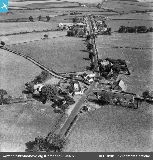
SAW026339 SCOTLAND (1949). Springfield, general view, showing Old Blacksmith's Shop, Bensmoor Road and Main Street. An oblique aerial photograph taken facing east.
    © Copyright OpenStreetMap contributors and licensed by the OpenStreetMap Foundation. 2025. Cartography is licensed as CC BY-SA.
  
Nearby Images (9)
Details
| Title | [SAW026339] Springfield, general view, showing Old Blacksmith's Shop, Bensmoor Road and Main Street. An oblique aerial photograph taken facing east. | 
| Reference | SAW026339 | 
| Date | 1949 | 
| Link | NRHE Collection item 1269468 | 
| Place name | |
| Parish | GRETNA | 
| District | ANNANDALE AND ESKDALE | 
| Country | SCOTLAND | 
| Easting / Northing | 332116, 568368 | 
| Longitude / Latitude | -3.0614691305573, 55.005169756661 | 
| National Grid Reference | NY321684 | 
Pins
Be the first to add a comment to this image!
 
             
  ![[SAR008922] General View Gretna, Dumfries-Shire, Scotland. An oblique aerial photograph taken facing North/West.](http://britainfromabove.org.uk/sites/all/libraries/aerofilms-images/public/100x100/SAR/008/SAR008922.jpg) 
  
                                          ![[SAW026336] Old Blacksmith's Shop, Bensmoor Road, Springfield.  An oblique aerial photograph taken facing north.](http://britainfromabove.org.uk/sites/all/libraries/aerofilms-images/public/100x100/SAW/026/SAW026336.jpg) 
 ![[SAW026337] Old Blacksmith's Shop, Bensmoor Road, Springfield.  An oblique aerial photograph taken facing north.](http://britainfromabove.org.uk/sites/all/libraries/aerofilms-images/public/100x100/SAW/026/SAW026337.jpg) 
 ![[SAW026338] Springfield, general view, showing Old Blacksmith's Shop, Bensmoor Road and Gretna Loaning.  An oblique aerial photograph taken facing north.](http://britainfromabove.org.uk/sites/all/libraries/aerofilms-images/public/100x100/SAW/026/SAW026338.jpg) 
 ![[SAW026339] Springfield, general view, showing Old Blacksmith's Shop, Bensmoor Road and Main Street.  An oblique aerial photograph taken facing east.](http://britainfromabove.org.uk/sites/all/libraries/aerofilms-images/public/100x100/SAW/026/SAW026339.jpg) 
 ![[SAW043382] Springfield, general view, showing Old Blacksmith's Shop, Bensmoor Road.  An oblique aerial photograph taken facing north-east.](http://britainfromabove.org.uk/sites/all/libraries/aerofilms-images/public/100x100/SAW/043/SAW043382.jpg) 
 ![[SPW040233] Old Blacksmith's Shop, Bensmoor Road, Springfield.  An oblique aerial photograph taken facing north.](http://britainfromabove.org.uk/sites/all/libraries/aerofilms-images/public/100x100/SPW/040/SPW040233.jpg) 
 ![[SPW040234] Old Blacksmith's Shop, Bensmoor Road, Springfield.  An oblique aerial photograph taken facing north-east.](http://britainfromabove.org.uk/sites/all/libraries/aerofilms-images/public/100x100/SPW/040/SPW040234.jpg) 
 ![[SAW043381] Springfield, general view, showing Old Blacksmith's Shop, Bensmoor Road.  An oblique aerial photograph taken facing north.](http://britainfromabove.org.uk/sites/all/libraries/aerofilms-images/public/100x100/SAW/043/SAW043381.jpg)