
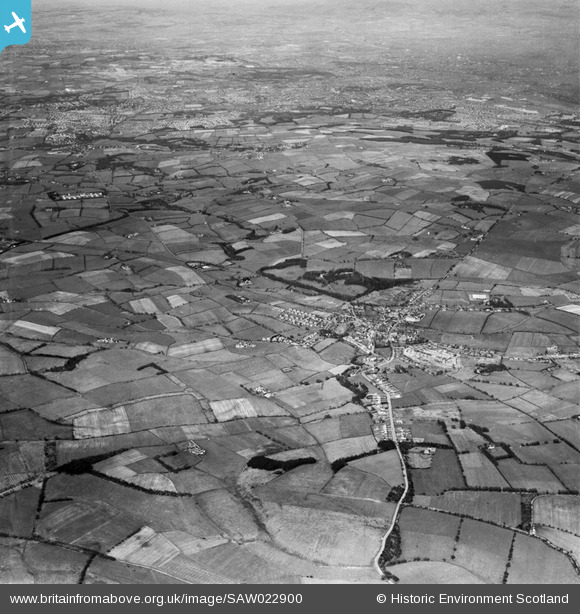
SAW022900 SCOTLAND (1949). East Kilbride, general view. An oblique aerial photograph taken facing north-west.
© Copyright OpenStreetMap contributors and licensed by the OpenStreetMap Foundation. 2026. Cartography is licensed as CC BY-SA.
Details
| Title | [SAW022900] East Kilbride, general view. An oblique aerial photograph taken facing north-west. |
| Reference | SAW022900 |
| Date | 1949 |
| Link | NRHE Collection item 1269250 |
| Place name | |
| Parish | EAST KILBRIDE (SOUTH LANARKSHIRE) |
| District | EAST KILBRIDE |
| Country | SCOTLAND |
| Easting / Northing | 262690, 654810 |
| Longitude / Latitude | -4.1888827092389, 55.767132127636 |
| National Grid Reference | NS627548 |
Pins

stephen |
Saturday 16th of November 2013 08:22:10 PM | |
|
Proctoa |
Friday 28th of December 2012 03:16:18 PM | |
|
graham |
Wednesday 27th of June 2012 11:02:42 PM | |
|
AlMu |
Wednesday 27th of June 2012 12:59:38 PM | |
|
Gordonm2 |
Tuesday 26th of June 2012 05:31:32 PM |
User Comment Contributions
AA Battery, East Kilbride. |
cptpies |
Thursday 19th of December 2013 03:07:49 PM |