
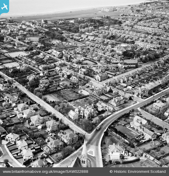
SAW022888 SCOTLAND (1949). Ayr, general view, showing Carrick House, Carrick Road and Ayr St Columba Church, Midton Road. An oblique aerial photograph taken facing north-west.
© Copyright OpenStreetMap contributors and licensed by the OpenStreetMap Foundation. 2026. Cartography is licensed as CC BY-SA.
Nearby Images (3)
SAW022888

SAW022890

SPW019514

Details
| Title | [SAW022888] Ayr, general view, showing Carrick House, Carrick Road and Ayr St Columba Church, Midton Road. An oblique aerial photograph taken facing north-west. |
| Reference | SAW022888 |
| Date | 1949 |
| Link | NRHE Collection item 1269239 |
| Place name | |
| Parish | AYR |
| District | KYLE AND CARRICK |
| Country | SCOTLAND |
| Easting / Northing | 233717, 620721 |
| Longitude / Latitude | -4.6296734398395, 55.452035851042 |
| National Grid Reference | NS337207 |
Pins
Be the first to add a comment to this image!