
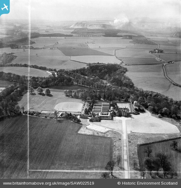
SAW022519 SCOTLAND (1949). Clifton Hall, Newbridge. An oblique aerial photograph taken facing west. This image has been produced from a crop marked negative.
© Copyright OpenStreetMap contributors and licensed by the OpenStreetMap Foundation. 2025. Cartography is licensed as CC BY-SA.
Nearby Images (5)
SAW022519

SAW022517

SAW022520

SAW022518

SAW022521

Details
| Title | [SAW022519] Clifton Hall, Newbridge. An oblique aerial photograph taken facing west. This image has been produced from a crop marked negative. |
| Reference | SAW022519 |
| Date | 1949 |
| Link | NRHE Collection item 1268956 |
| Place name | |
| Parish | KIRKLISTON (CITY OF EDINBURGH/MIDLOTHIAN) |
| District | CITY OF EDINBURGH |
| Country | SCOTLAND |
| Easting / Northing | 310950, 670950 |
| Longitude / Latitude | -3.4251956542515, 55.923411279245 |
| National Grid Reference | NT110710 |
Pins

Andy A |
Thursday 2nd of January 2014 03:23:26 PM |
User Comment Contributions
pumpherston oil works & shale bings in the background |
mrswine |
Friday 6th of July 2012 11:45:43 PM |